Geography; Nature and climate; Demography; History; Wars;
Culture ; Art; Film; Music; Politics; Political parties ; Defense;
Peace movements; Religion; Social conditions ; Education ,
Economics and Arms trade.
Géographie; Nature et climat; Démographie;
Guerres; Histoire; Culture ; La musique; Politique; Partis
politiques ; La défense; Mouvements de paix; Religion;
Conditions sociales ; Éducation; Économie et commerce
des armes
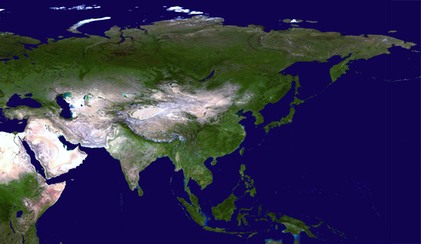
Geography: India is a tropical Asian republic with borders to
Bangladesh, Bhutan, China, Myanmar, or Burma, Nepal, Pakistan and
Tibet and with coastline to the Indian Ocean. Kashmir. Andaman and
Nicobar Islands. India's neighbor to the island nation of Sri
Lanka.
Indiens delstater og territorier:
Delstater: Andhra Pradesh ; Arunachal Pradesh ; Assam ; Bihar ;
Chattisgarh ; Goa ; Gujarat ; Haryana ; Himachal Pradesh ; Jammu og
Kashmir ; Jharkhand ; Karnataka ; Kerala ; Madhya Pradesh ;
Maharashtra ; Manipur ; Meghalaya ; Mizoram ; Nagaland ; Orissa ;
Punjab ; Rajasthan ; Sikkim ; Tamil Nadu ; Tripura ; Uttarakhand ;
Uttar Pradesh ; Vestbengalen.
Unionsterritorier: Andamanerne og Nicobarerne ; Chandigarh ; Dadra
og Nagar Haveli ; Daman og Diu ; Lakshadweep ; Pondicherry.
Census of India 2011 Administrative Atlas of India.
-
http://censusindia.gov.in/2011census/maps/administrative_maps/Final%20Atlas%20India%202011.pdf
Satellite Image Atlas of Glaciers of the World, 2010.
- http://pubs.usgs.gov/pp/p1386/
U.S. Geological Survey Professional Paper 1386, Satellite Image
Atlas of Glaciers of the World, contains 11 chapters designated by
the letters A through K. Chapter A provides a comprehensive, yet
concise, review of the "State of the Earth's Cryosphere at the
Beginning of the 21st Century: Glaciers, Global Snow Cover,
Floating Ice, and Permafrost and Periglacial Environments," and a
"Map/Poster of the Earth's Dynamic Cryosphere," and a set of eight
"Supplemental Cryosphere Notes" about the Earth's Dynamic
Cryosphere and the Earth System. The next 10 chapters, B through K,
are arranged geographically and present glaciological information
from Landsat and other sources of historic and modern data on each
of the geographic areas. Chapter B covers Antarctica; Chapter C,
Greenland; Chapter D, Iceland; Chapter E, Continental Europe
(except for the European part of the former Soviet Union),
including the Alps, the Pyrenees, Norway, Sweden, Svalbard
(Norway), and Jan Mayen (Norway); Chapter F, Asia, including the
European part of the former Soviet Union, China, Afghanistan,
Pakistan, India, Nepal, and Bhutan; Chapter G, Turkey, Iran, and
Africa; Chapter H, Irian Jaya (Indonesia) and New Zealand; Chapter
I, South America; Chapter J, North America (excluding Alaska); and
Chapter K, Alaska. Chapters A–D each include map plates.
Geografihistoriske primærkilder og fremstillinger /
Geography Historical primary sources and
presentations /
Géographie des sources historiques primaires:
A Voyage in the Indian Ocean and to Bengal, undertaken in
the Years 1789 and 1790: Containing an Account of the Sechelles
Islands and Trincomale. / : Louis de Grandpré.
- London : G. and J. Robinson, 1803.
- http://www.wdl.org/en/item/2397/
Tabula Peutingeriana
- http://www.euratlas.net/cartogra/peutinger/index.html
Carsten Niebuhr ekspeditionen. Stig T. Rasmussen [red]: Den
arabiske rejse 1761-1767: En dansk ekpedition set i
videnskabshistorisk perspektiv. Rosinante, 1990.
Vasco de Gama; oder, die Auffindung des Seeweges nach Indien
(1882).
- http://www.archive.org/details/vascodegamaoder00mlgoog
Great Britain India Office: A Catalogue of Manuscript and Printed
Reports, Field Books, Memoirs, Maps ... (1878).
- http://www.archive.org/details/acataloguemanus00offigoog
Clements R Markham: A Memoir On The Indian Surveys. 2nd Ed.
(1878).
- http://www.archive.org/details/memoirontheindia025502mbp
Great Britain India Office: A catalogue of maps of the British
possessions in India and other parts of Asia. [With] A ...
(1870).
- http://www.archive.org/details/acataloguemapsb00offigoog
India in the fifteenth century : being a collection of narratives
of voyages to India, in the century preceeding the Portugese
discovery of the Cape of Good Hope ; from Latin, Persian, Russian,
and Italian sources, now first translated into English (1857).
- http://www.archive.org/details/indiainfifteenth00majorich
The Great Trigonometrical Survey of India in a Historical
Perspective. / : Rama Deb Roy. Indian Journal of History of
Science, 21(1): 22-32 1986.
-
http://www.new1.dli.ernet.in/data1/upload/insa/INSA_1/20005b5b_22.pdf
Historical Records of Survey of India Vol 1-3, 1945-.. / : R H
Phillimore.
Digital Himalaya: Rare Books & Manuscripts
- http://www.digitalhimalaya.com/collections/rarebooks/
-
https://archive.org/details/HistoricalRecordsOfSurveyOfIndiaVol1ByColRHPhillimore
-
https://archive.org/details/HistoricalRecordsOfSurveyOfIndiaVol1-3
Historical Records Of Survey Of India Vol 4 By Phillimore.
-
https://archive.org/search.php?query=subject%3A%22Surveying+Exploration+India%22
-
https://archive.org/details/HistoricalRecordsOfSurveyOfIndiaVol4ByPhillimore
Volume of Col (later Brigadier) R H Phillimore's monumental work,
the Historical Records of the Survey of India, are uploaded here.
There was also voulme 5 published in 1968, after Phillimore's
death. This 5th volume was subsequently with drawn by the Govt of
India, as there were issues of border security to do with the
McMahon line between India and China and so on. However, a
downloadable copy of this volume can be accessed at the Cambridge
Yale site : DigitalHimalaya
- http://www.digitalhimalaya.com/collections/rarebooks/
Reginald Phillimore's work covers the early 18th Century, East
India Company, days of surveying in India, reaching up to the late
19th Century and includes the progress of the Great Trigonometrical
Survey of India, the estimation of the height of Mt Everest, the
development of surveying techniques and instruments as well as the
difficulties presented by the terrain, climate and political
developments including wars between the British and the Indian
states as well as the Afghans, Burmese and so on. Inextricably
linked in part with the Great Game, this set is a historical
account of those times in surveying, complete with extracts from
official minutes and reports and comprehensive biographies of the
various surveyors, many of them illustrious names i the discipline.
This set, per favour of Pahar dot in, includes all the maps, many
in colour, including fold out maps in full size scan
presentation